The latest bug-fix release in our stable 2020.3 series was released today: we’re up to version 2020.3.12 now. As usual there’s small bug-fixes and improvements in various areas. You can see the full list of changes on our wiki.
For users who take advantage of our Swift integration to fly on VATIM, be aware that there’s currently an incompatibility with the VATSIM servers until some extra updates are made to FlightGear: so there will be a 2020.3.13 release coming in the next few weeks, which restores Swift compatibility.
Go to our downloads page to get the latest version: if you’re on Windows you can use the update installer to reduce the size of your download considerably.
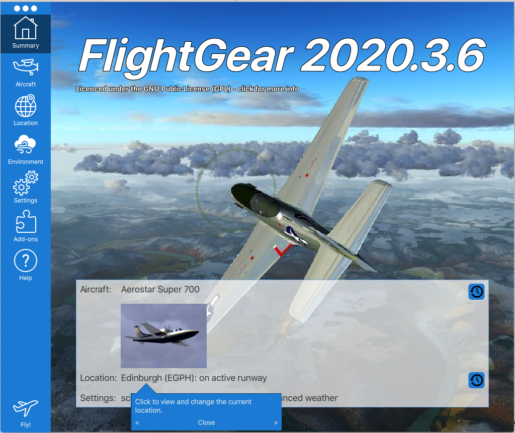
The next bug-fix release of FlightGear, version 2020.3.6, will be released in a few days time. As usual, this includes many bug-fixes based on crash reports and feedback from users. Also included is a new addition to help new users find their way around the software: getting started tips.
FlightGear 2020.3.6 launcher, with a getting started tip visible
To really be useful, these hints should appear in the user’s own language. (Along with the rest of the software, of course). Translating FlightGear is a volunteer effort like everything else we do : if you speak a language which is not currently supported, and would like to add that language, it’s a great way to start contributing.
The newest release in the 2020.3 stable series, 2020.3.5, was released a few days ago. It contains hundreds of bug-fixes and improvements based on feedback, testing and crash-reports received since 2020.3.0 was released earlier this year.
Download it from the usual place – if you want to see the detailed list of changes, they’re listed here.
The biggest change we’ve made is for Windows: aircraft and scenery which are downloaded automatically, will now be stored in a new folder, instead of one inside ‘Documents’. This is because some optional Windows security features don’t allow us to add new files inside Documents. If you’re upgrading from an older version, you’ll be promoted to move any existing downloads to their new recommended location, so you don’t need to download them again.
We’ve also published a detailed tour of Iceland, to give ideas where to start exploring the new default airport and location for 2020.3 – and show of some of the beautiful scenery, models and effects created by different contributors.
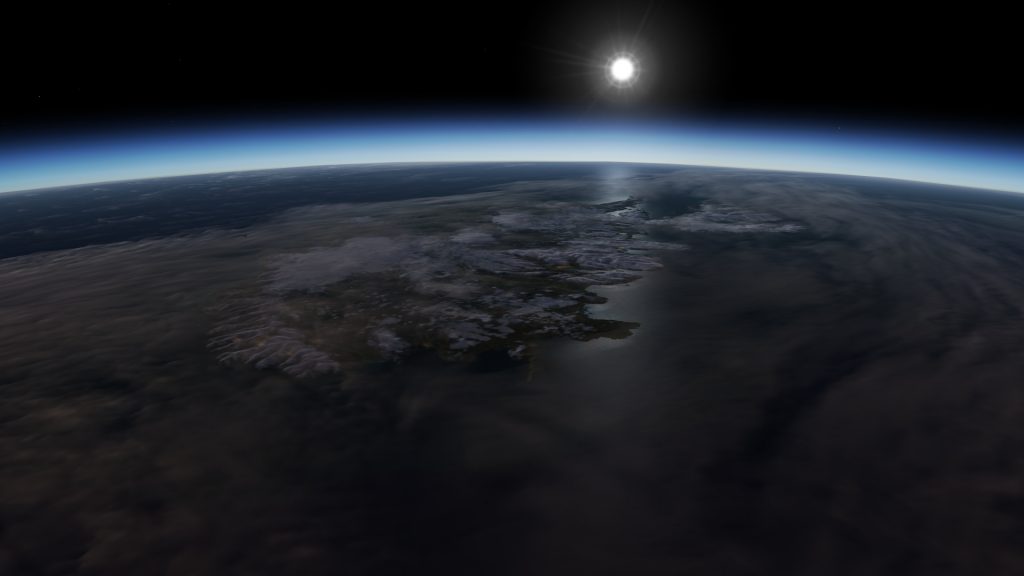
FlightGear’s 2020.3 Long Term Stable (LTS) release has moved to the world’s newest country, geologically speaking, Iceland.
Welcome to Keflavik and Iceland
Iceland viewed from space, using FlightGear’s orbital renderer Earthview
Keflavík International Airport (BIKF) is the featured airport for the LTS. Keflavík airport is the largest airport in Iceland with 10 million people passing through in 2018. It has both civilian and military terminals. Keflavík serves as the international gateway to Iceland, and its 3 km runways were a Space Shuttle emergency landing site.
The gateway to Iceland
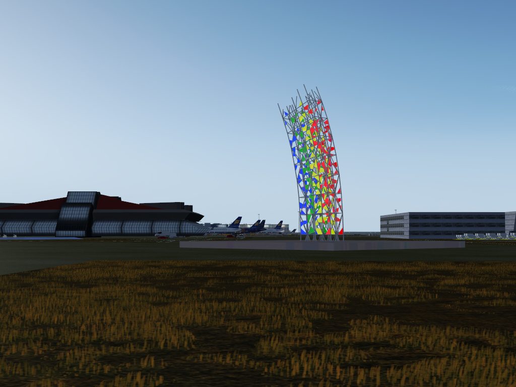
Keflavik Airport is modeled in detail, including art installations at the airport.
‘Rainbow’ (“Regnbogi”) sculpture near the Leif Eriksson terminal‘The Jet Nest’ (“Þotuhreiður”) sculpture
For Iceland there are also buildings, roads, and objects like pylons for the whole country generated from Open Street Maps (OSM) data by the OSM2City project. These are available as a separate download. OSM2City buildings compatible with 2020 LTS have improved visuals and render faster.
View looking over Reykjavík Airport (BIRK) in the capital city of Reykjavík, with buildings, roads, and objects based on OSM data:
A land born of fire and ice
A land of fire, as well as ice, Iceland is still growing, and new parts are still being formed under the dancing Northern Lights (remember to turn Auroras on and watch!). An example is the island of Surtsey formed in 1963 – and Surtsey’s two volcanic vents are now modeled with multiple levels of activity in the LTS. Surtsey is within viewing distance from Airport (BIVI).
Volcanic activity at the main crater in Surtsey
Iceland’s volcanoes are often strato-volcanoes, in contrast to the shield volcanoes of Hawaii – the C172p tutorial airport (PHTO) is located in a town at the foot of two huge shield volcanoes. Strato-volcanoes have steeper sloping sides, as the lava that comes up often is more viscous for periods of time – it flows less easily, like honey compared to water. This lava becomes hard before spreading far. Lava, before it reaches the surface, is called magma. Strato-volcanoes have periods where the magma coming up is viscous, and eruptions can be explosive – as gasses dissolved in the magma remain trapped. These eruptions can cause craters. Shield volcanoes only tend to have magma that flows easily, so they have very shallow slopes (as low as 5 degrees) as the lava spreads far. Iceland does have shield volcanoes, but they are smaller. The volcanoes you see have been eroded depending on how old they are
Mount Herdubreid (a table mountain) is a volcano in Vatnajökull National Park, Iceland. The volcanic desert it sits on is a lava field created from easily flowing eruptions of nearby shield volcanoes:
When magma is expelled from a volcano, the cavities that it used to be in underground become empty and often collapse leaving depressions called calderas. You’ll notice both craters and calderas on top of volcanoes in Iceland are often capped by glaciers.
A caldera in the central highlands with a large lake, in the colder part of the year. There is a thin layer of snow, and the water has some ice cover – environment simulation options like these are set from Environment menu > Environment Settings:
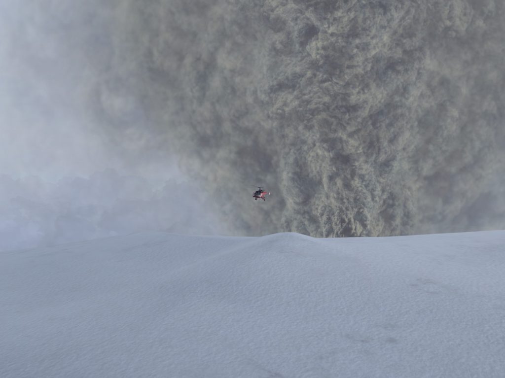
FlightGear models several Icelandic volcanoes at multiple activity levels; Eyjafjallajökull, Surtsey, and Katla. Eyjafjallajökull and its cloud of volcanic ash caused severe disruption to aviation in 2010. Katla is a far bigger volcano located nearby. Past eruptions at Katla have ranged from a Volcanic Explosivity Index (VEI) of 4 like Eyjafjallajökull, to a VEI of 6 like Mount Pinturbo (1991) or Krakatoa (1883). Scarily Katla is somewhat overdue for an eruption. Screenshots don’t do justice to the boiling turbulence of a volcanic plume like Katla. We won’t spoil it, so you can discover and appreciate the scale of the forces involved. FG’s Advanced Weather engine now models the increased turbulence in wind-fields associated with volcanic activity, so beware!. To set the activity level of a volcano fly to the area, and look in Environment > Volcanoes to choose from the volcanoes in that area.
Re-creating the Icelandic setting in FlightGear
Iceland has rugged volcanic terrain with glaciers, deserts, ice caps, marshes, fjords and a cool wet climate. There is plenty to discover. The island has only been colonised recently by both nature and people. There are almost no trees, as the young forests were cleared by early settlers.
To re-create the stark sub-polar setting, remember to turn on overlays which add high resolution 3D detail, and set Transparency Anti-Aliasing to MSAA in the GPU control panel (or super-sampling on powerful GPUs). As Iceland has few trees, people with older GPUs may find they have spare performance and can use overlays in Iceland.
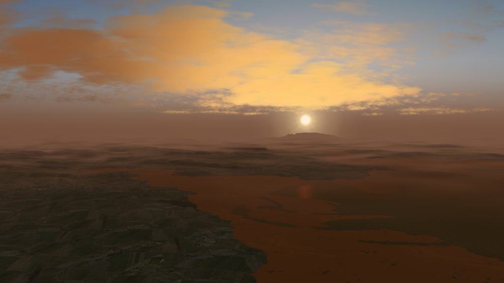
A place needs 4 dimensions to describe it, 3 in space and 1 in time. Any default setting can only be a moment in time, and in FlightGear the ever-changing cycles of nature are simulated from the Environment > Environment Settings menu. In FlightGear’s environment sliders, Iceland is often suited being towards the autumn season with wet ground and moss. The more northern seas away from the south coast can ice up, so remember the ice cover control. The snowline is set in Environment Settings too, as is the thickness of snow. Remember to adjust them. The snow-line from METAR is just a guess based on weather and latitude. How much snow is on the ground depends on the history of snowfall, and how much snow melted or evapourated because of weather or temperatures.
SummerTowards autumnThin patchy snow
FlightGear’s Advanced Weather (AW) engine simulates terrain-driven, continually evolving, weather on multiple scales – you can watch the lifecycle of a single cumulus cloud from the first wisps to eventual decay depending on the conditions it encounters. Look under Environment > Detailed Weather > Advanced Weather settings for controls. To activate the weather simulation, choose weather scenarios in the list from “Core high pressure region”, through to “Warm Sector” – these describe the air masses around your starting point. “Fair Weather” is also fine, as it’s just “Core high pressure region”. Other types of scenarios will do things like tie weather to best guesses at vague METARs, and apply the same weather everywhere all the time. Using live METARs will additionally tie FG to weather conditions for the current time of day and season for that location – regardless of the time, date, and season you simulate.
To recreate the turbulent windfields associated with the rugged mountainous terrain make sure terrain effects, terrain presampling, and thermal generation are enabled. The controls for detailed gust controls, cloud shadows, realistic visibility, ground haze and structure are also there. For shorter trips you may want to decrease the sizes of distinct air masses and scales of weather patterns, to see more change, more often. There are far more weather variables under the hood than are (and can be) exposed in the GUI. These weather variables are randomised each time the AW simulation is restarted – press ‘Apply’ to restart. What you see around your starting point, for each scenario very roughly describing airmasses around you like “Border of a high pressure region”, is just one of a huge number of weather possibilities that can exist with those airmasses – for that terrain, at that latitude, and at that time. Remember that to recreate Iceland’s cool temperatures, the temperature offset needs be lowered to adjust the weather scenarios used AW simulation – put in a negative value to lower temperatures like “-25”. As temperatures decrease, rain will turn to snow or hail as appropriate. With lower temperatures you’ll be rewarded more often with stunning ice halos around the sun and other types of scattering by ice crystals in clouds.
Aurora Borealis, and sun halo. The halo is caused by light bouncing off ice crystals in the atmosphere. The halo is red as the sunlight from the low sun is red. Try setting ‘time warp’ to 4x or more in Environment > Time to see the Aurora dance a bit more clearly.
Sun dogs on both sides of the sun caused by ice crystals, and a faint ice halo. The vertical spike of light at the center of the sun is a light pillar (sun pillar) also caused by ice crystals.
While the mythical pot of gold at the end of a rainbow is hard to find, you have found a country with a lot of rainbows. Iceland’s wet, changing, weather and a sun that is often low means a lot of chances to go rainbow hunting. Rainbows aren’t just a texture in FlightGear, they are simulated. Like halos, rainbows are the ALS light simulation interacting with the weather simulation – rainbows are light bouncing towards you from rain droplets. Rain falls under specific clouds, and you may only see part(s) of a rainbow. Unlike halos, a rainbow isn’t around the sun. A rainbow is a large circle around the point opposite the sun from you, the anti-solar point. To locate this point draw an imaginary line from the sun to you. To see a rainbow, you should be between the rain volume and the sun. The intensity of rainbow depends on things like how heavy the rain is and the size of raindrops. Very light rain (drizzle) makes subtle rainbows. To see a rainbow, there needs to be at least one gap in cloud cover for the sun to shine through. Flying when the sun is low increases your chance of spotting rainbows.
Exploring a new land
A DC-3 like this once landed with skis on the Vatnajökull ice cap. It was trying to rescue the crew from a DC-6B. The DC-3 was not able to leave, and both crews were rescued by a different rescue team. The DC-3 was abandoned over winter and buried in a snowstorm. The DC-3 was later dug up, then buried by a sudden snowstorm, and dug up again. It still had enough battery power and fuel to take off and fly to Reykjavík:
You can use craft such as the Cessna 172 or 182, or the rugged DHC-6 Twin Otter in your adventures exploring Iceland. Variants among these include support for floats for hopping between the dramatic fjords of the north/north-west (e.g. Ísafjörður – BIIS), as well as skis and winter kits to explore the many glaciers and icecaps. Some have bush tires to try your luck in the desert areas of the central highlands, or the moss covered lava fields of the south/south-west. To select craft variants, look in the launcher dropdown menu and the craft’s menu inside the simulator. Helicopters such as the Eurocopter EC 135, Alouette III, Eurocopter EC130/H130, and Robinson R-44 will let you reach a variety of places – some have floats (R-44, EC130/H130) and snowshoes too.
As Iceland was settled by humans recently, there are probably places that no one has touched down, or set foot on, before. There are also places like Surtsey that are off-limits to visitors to avoid contamination. Other places like erupting volcanoes are simply dangerous. In some aircraft, like Neil Armstrong, you can get out and walk in the simulation where no one has gone before, after a successful landing.
Over the meltwater lake (terminal lake) at the end of a glacier (known as the glacier terminus or snout):
For the first time, FlightGear is taking part in Navigraph’s annual flight sim survey, the largest of its kind (with 17,800 participants in 2019)! By participating, you can help establish a broad overview of the needs and wishes of flight sim users. While the survey is traditionally focused on the big commercial players, we got to help shape some of the questions this year. By participating, you get to show that our open-source flight simulator is a serious alternative (and maybe you learn a bit more about the width of the flight sim world too).
The
survey closes on November 23 and results will be published on the 10th
of December. We receive an extract from the (anonymous) answers of our
own FlightGear community, so we can see how our community differs from
the general flight sim public and hopefully learn some more about our
own users.
After two years of work, the new stable release of the free open-source flight simulator FlightGear is finally here: 2020.3! It replaces 2018.3 as our supported, stable version. There’s many updated aircraft, visual enhancements and a new default airport/region: Keflavík (BIKF) in Iceland.
The Alouette III getting close to a volcanic plume.
As always there’s also internal improvements to the flight models and other simulation systems, bug-fixes, and performance improvements.
We’re going to take a proper tour around Iceland in another post, and detail some of the improved feature and aircraft over the next few months. The full change-log is available here. But we’d like to quickly share some highlights below.
Iceland is the world’s newest country, if you’re speaking geographically: a land of ice and fire. FlightGear models several volcanoes with multiple levels of activity: Eyjafjallajökull which disrupted aviation in 2010, Surtsey, and the brooding, powerful, Katla.
Iceland seen from space (using EarthView imagery)
Keflavík International Airport (BIKF) is the featured airport for the release: due to its remote location in the north Atlantic, the long runways have been used by all kinds of aircraft over the years; especially as stop-over for early transatlantic services, but also patrolling military aircraft and transports.
Aircraft
The A320 has been overhauled, with accurate simulation and display of the flight management systems.
The C182 gained an excellent integration of the FG1000 glass-cockpit, as did the J3 Cub and the Diamond DA40. More aircraft installations are in development.
The SEPCAT Jaguar GR.1, Bombardier Q400 and twenty more aircraft were added.
Feature highlights
There’s been many changes since the last release, but here’s a few particular interesting ones:
FlightGear now simulates tides covering and uncovering shallow areas (littoral areas), like tidal flats (mudflats). You can see tides as the day progresses – there are two highs and two lows per day.
Morecambe bay at low tide
Textures can be cached & compressed for faster loading and reduced memory use, giving better performance.
Connection to the VATSIM network via SWIFT is officially supported.
Better translation support, and handling of non-ASCII file names.
Many view improvements, including a new Tower-AGL view.
Community member M. Spieler is running an online survey to learn more about who uses FlightGear, and what kind of setups they have. If you’d like to take part, you can fill in the survey here.
(The results will be shared on the forum at the end of August)
FlightGear 2020.1.2 contains bug-fixes and improvements to the 2020.1 release. For users experimenting with the Compositor renderer, there’s now clearer information on startup, and a simple interface to select the display settings (performance or higher quality)
Bugs affecting macOS users when updating from an older version were fixed, as well as other bugs in GPX flightplan loading.
The FlightGear development team is delighted to announce the 2020.1 release of FlightGear, the free, open-source flight simulator. This version is a preview of our next stable release, containing many new features and improvements.
Enhancements since 2019.1 include a developer preview of the upcoming Compositor graphical rendering framework as a separate pre-built binary, better aircraft carrier support, improvements to both the JSBSim and YASim flight dynamics models, better view options, more efficient and improved OpenStreetMap buildings and translation of the UI into Polish and Slovak. Here’s the complete list of changes.
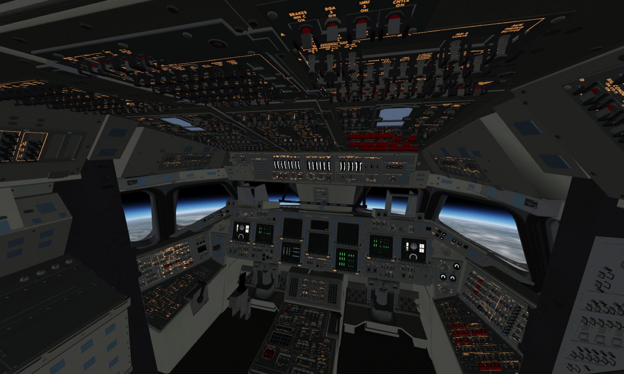
Many aircraft have been updated, including major updates to the Boeing 777, Airbus A320, Antonov AN-24, F-16, Piper J3Cub, Saab JA37 Viggen, Piper PA28 Cherokee, Bombardier Q-400, Space Shuttle.
Founded in 1997, FlightGear is developed by a worldwide group of volunteers, brought together by a shared ambition to create the most realistic flight simulator possible that is free to use, modify and distribute. FlightGear is used all over the world by desktop flight simulator enthusiasts, for research in universities and for interactive exhibits in museums.
There’s a new stable (long-term supported) release just available on SourceForge : 2018.3.5. This contains some smaller bug-fixes but most importantly, the build now works correctly on macOS 10.15 Catalina. This required updating many internal aspects of how we build the software, which took considerable effort from a whole team of people.
Get the new release while it’s hot: from SourceForge.